Applications
Application Areas
The 3D subsurface and surface imaging capabilities of Kerberos™ and Lynx are useful for a wide range of applications, including:
Pavements
- As constructed information:
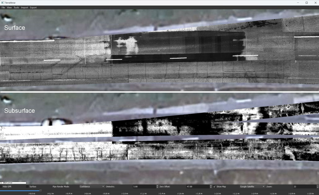
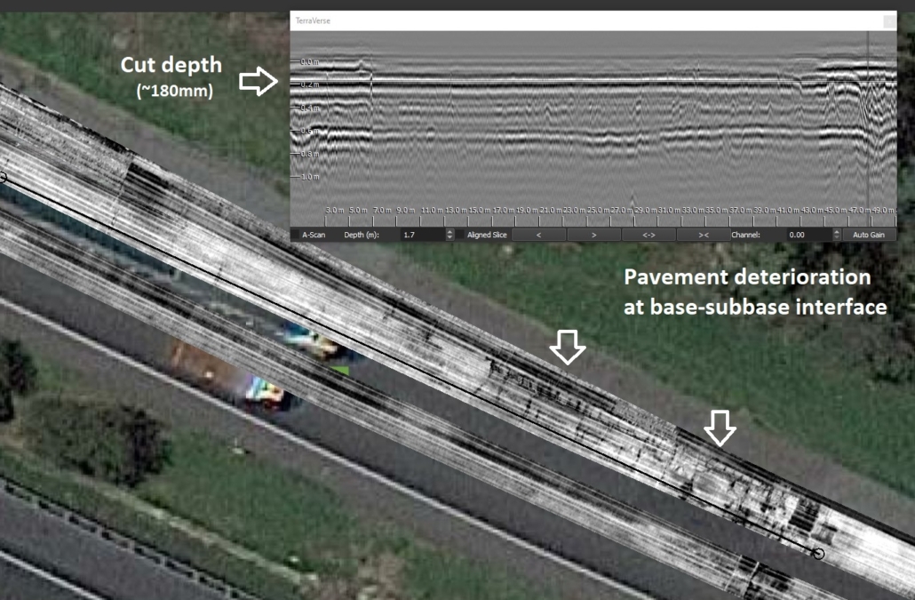
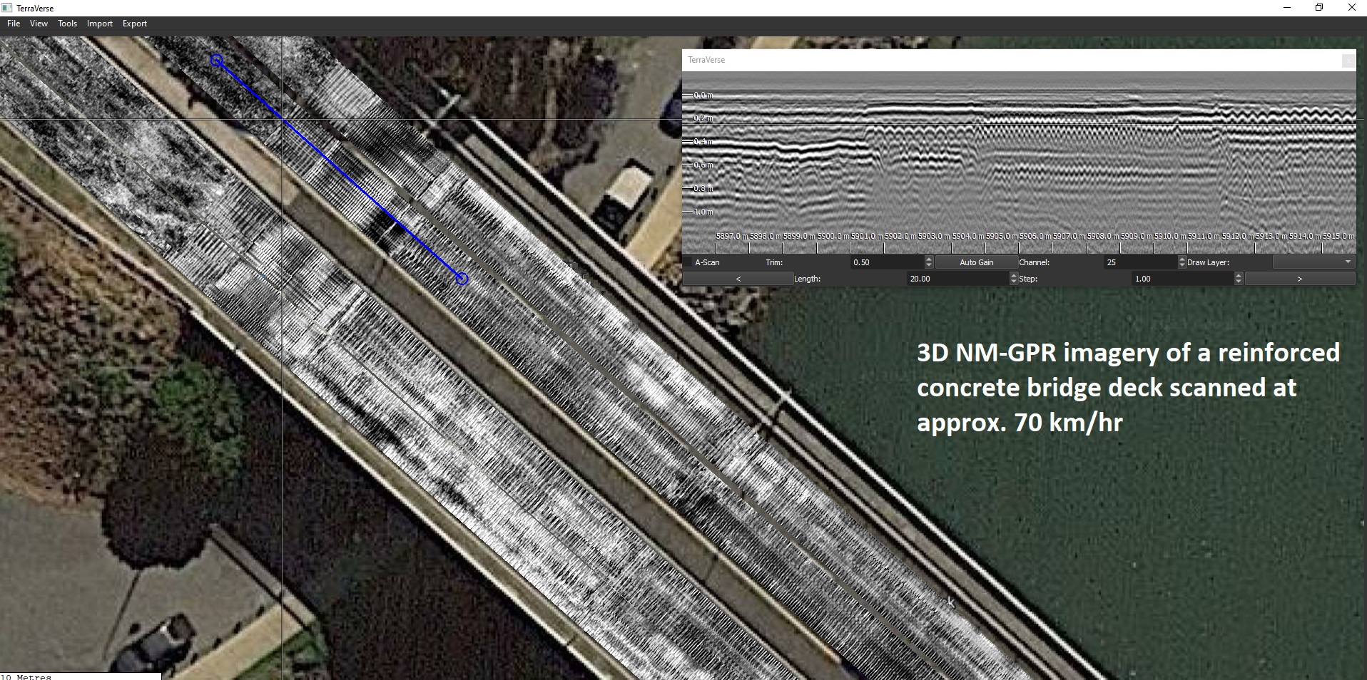
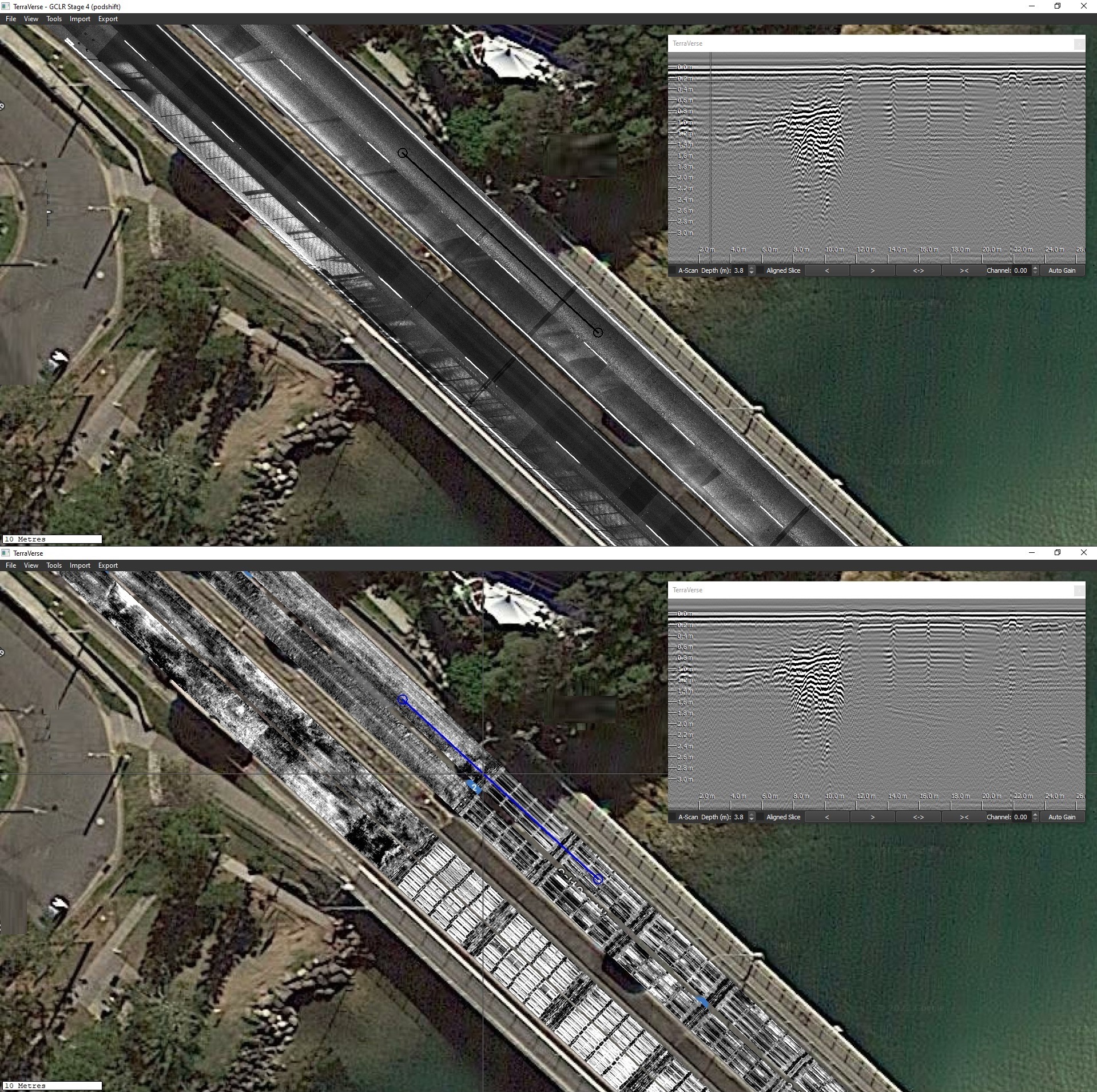
- Scan roads, airport pavements, bridge decks and bridge approaches to determine as-constructed details of pavements along the road, or continuous cross-sectional views across roads or multi-lane highways.
- Locate changes of pavement construction, even in large and complex multi-lane roads, viewed in elevation, cross-sectional or plan-view orientations.
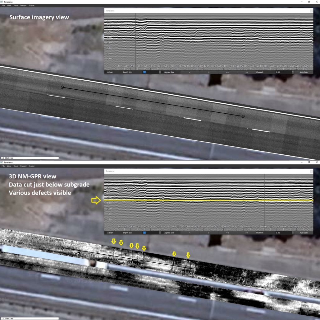
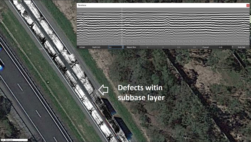
- Detect, locate and determine the type of prior pavement repairs. For example, distinguishing between steel-fibre concrete repairs versus reinforced concrete repairs; detect working platforms within the subgrade.
- Capture a snapshot of current surface & subsurface conditions for planning, monitoring or evidentiary purposes. For example, to document current conditions prior to large infrastructure projects or monitor the performance of completed works.
- Defects & obstructions:
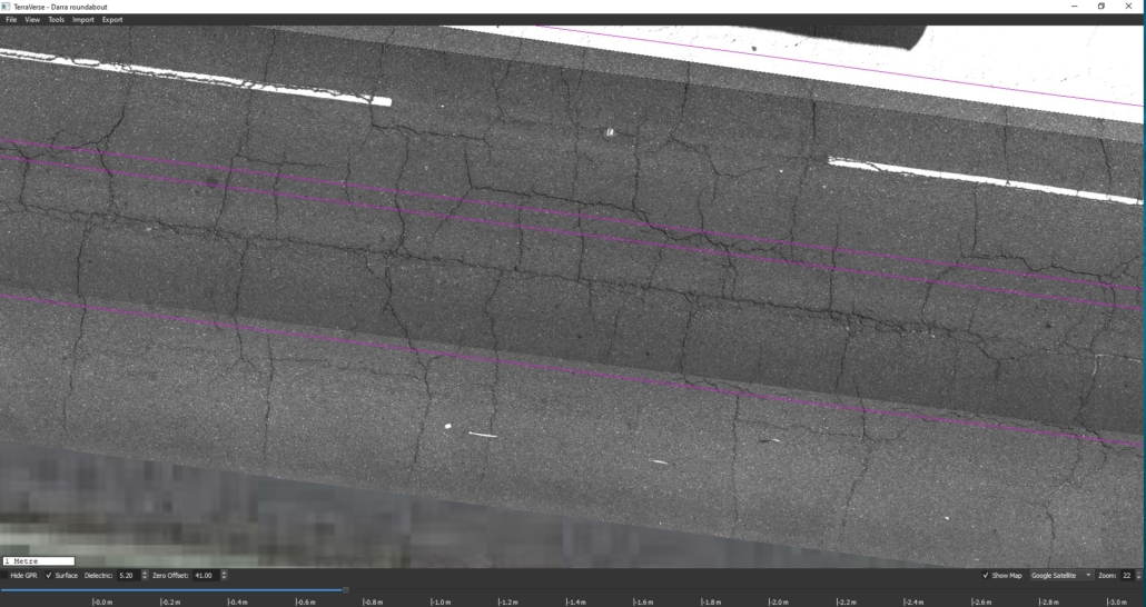
- Detect cracks within or underneath pavement layers
- Detect & map developing voids / sinkholes
- Detect shoving defects within failing asphalt layers
- Investigate the underlying causes and subsurface extent of defects visible at the road surface
- Detect & map the location of defunct subsurface infrastructure (e.g. tram tracks, utilities, pits, etc.) or other potential obstructions to remedial works (e.g. boulders, rock, etc.)
- Detect areas containing increased moisture.
- Optimise conventional investigations:
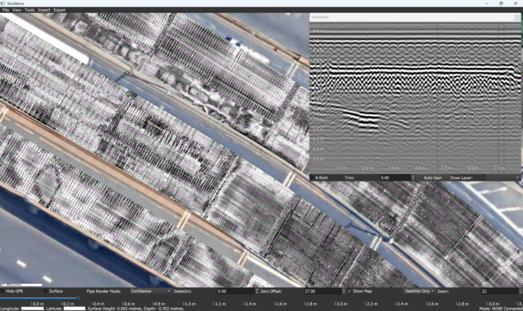
- Scan more of large sites quickly & easily, then distinguish homogenous & inhomogeneous areas.
- Use this information to optimise the number and value of cores and trenches by targeting them to representative locations.


 & surface imagery (right) for a site")
Subsurface Utilities / PUP
- Locate, map and estimate the depth of subsurface utilities
- Detect and map the location of buried pits, values, protection slabs
- Use surface feature “clues” (i.e. inlets, manholes, valves) to better understand site conditions to guide GPR interpretations

Bridges
- Mapping the depth of asphalt Deck Wearing Surface (DWS) to plan remedial works and determine rebar cover depth
- Identify underlying causes of bridge approach subsidence or other surface defects
- Capture surface imagery of existing condition, for monitoring or evidentiary purposes
Law enforcement
- Identifying the presence and precise location of buried objects or location of disturbed earth
Environmental
- Mapping the pattern of tree roots, determining near-surface geology, measuring the depth of capping layers, etc.
Archeology
-
- Locating and mapping buried structures, grave plots


