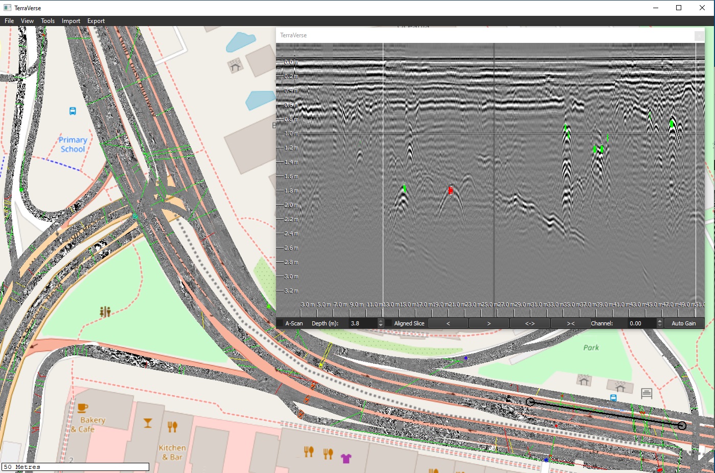
Case study: Locate utilities beneath roads
- Site: Urban highway site, approx. 7.5km long, with more than 40 intersections
- Objective: Locate utilities & other potential obstructions ahead of infrastructure installation
- Approach:
- Kerberos used to scan accessible highway pavement and intersection turnouts at traffic speeds
- Scanning performed without traffic control, within normal traffic flow
- Outcomes:
- Approx. 16 hours to scan entire site, including intersection turnouts
- Data gathered within normal traffic flow, traffic control not required
- > 600,000 m2 of 3D GPR combined into one large model of the site
- > 2100 linear features (mostly utilities) tagged within the model (coloured lines in above example)
- Multiple previously unknown utilities identified
- Other buried obstruction and features identified & reported
- Results exported into various formats for reporting to client
- Assessment completed without any pubic disruption
- Data used to guide vacuum excavation operations, which confirmed utility type & exact depth
- Client benefits:
- Coverage: Majority of site covered using road-based scanning early in the project, informing subsequent investigations & works.
- Forewarning: Locations of many unrecorded utilities & potential obstructions identified, informing future planning of subsequent works / investigations
- Precise: Vacuum excavation later confirmed actual utility locations were within approx. 100mm of GPR-determine locations (i.e. x-y positioning error)
- Cost & time: Majority of site covered in a fraction of the time & cost achievable by slower 3D or 2D GPR technologies.
- Viability: Conventional technologies infeasible, as coverage of 2D GPR scans are insufficient while traffic control costs of slow 3D GPR would have been excessive.
- Delay & disruption: Traffic-speed 3D GPR collection avoided significant costs & likely public disruption of traffic control measures.

