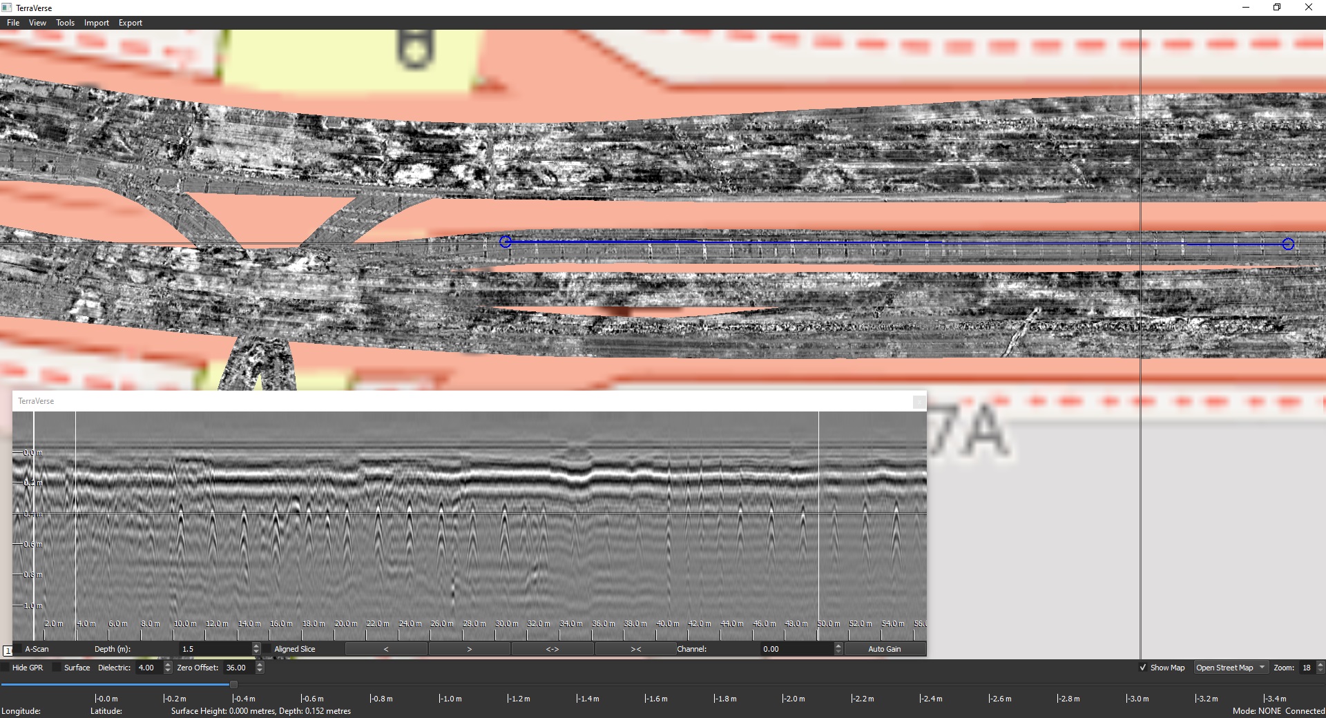
Case study: Buried tram tracks
- Site: Urban multi-lane road, approx. 5km length to be investigated
- Objective: Determine if tram tracks from defunct network were buried under road, and if present map locations
- Approach:
- Kerberos used to scan accessible highway pavement and intersection turnouts at traffic speeds
- Scanning performed without traffic control, within normal traffic flow
- Outcomes:
- Approx. 4 hours of daytime + 2 hours night time to scan site
- Traffic control not required
- Tram tracks were confirmed to be present under the road in various location
- Locations clearly visible within 3D GPR data
- Boundaries of tram tracks tagged in software & exported for reporting to client
- Assessment completed without any pubic disruption
- Client benefits:
- Confidence: Tram tracks were visually clear and unambiguous within GPR data, giving confidence that they had been reliably identified
- Clarity: Use of 3D GPR enabled extent of tram track locations to be precisely identified & reported
- Coverage: Majority of site covered with road-based scanning, providing confidence to proceed with project planning in these areas
- Cost & time: Majority of site covered in a fraction of the time and cost of slower 3D or 2D GPR technologies
- Delay & disruption: Traffic-speed 3D GPR collection avoided the significant costs & public disruption of traffic control measures

